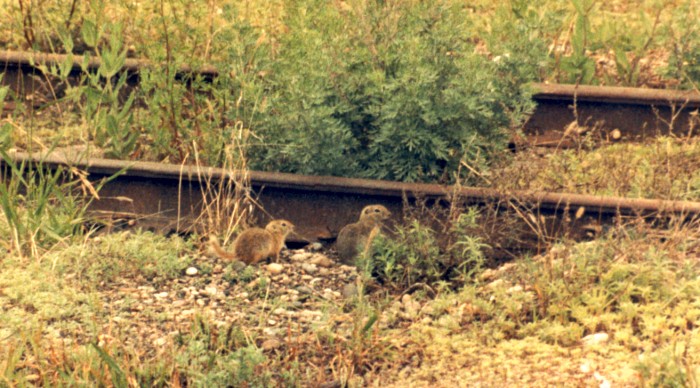
A couple of Richardson's ground squirrels are keeping an eye on me near a seldom-used track.
Their squeaks signal that danger has been spotted.
With grain elevators in the area, and leaking grain cars banging by, they find plenty to eat here.
Burrowed in the ground between the main lines, one wonders if and how well they nap.
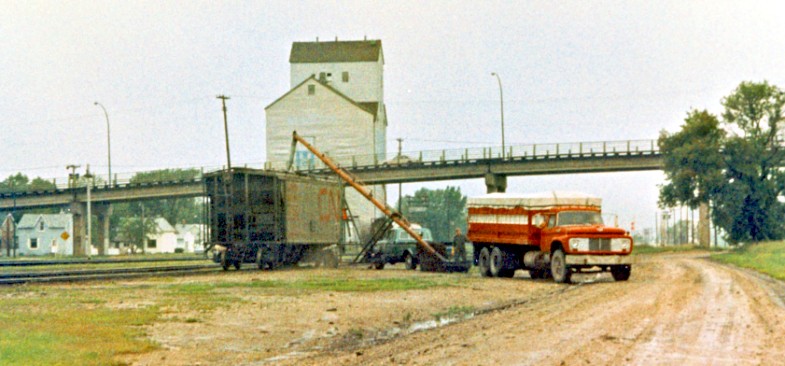
On a rainy vacation day, a 'special' cargo of grain is being loaded into a small ancient hopper car, spotted on a siding.
In almost all cases in 1985, grain was received, graded, and stored at local wooden grain elevators (background) ...
then loaded into 100 ton capacity cylindrical railway hopper cars.
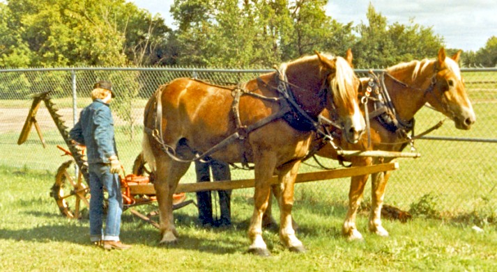
A horse-drawn mower is rigged up at the Mennonite Heritage Village museum at Steinbach, Manitoba.
The wheels are geared to the mower ... the mower assembly is visible in its raised position with the external teeth at the man's left elbow.
Within the assembly, a reciprocating bar, with sharp little triangular knives, cuts the tall hay stalks off close to the ground.
The operator sits on the mower and uses levers to engage, lower and raise the cutting bar.

The Manitoba Legislative Building in the evening.
The architecture contains various ancient symbols and/or mathematical details ... 'of mystery' ! ...
Easier to understand is a Mercury-like figure, coated in real gold, which can be seen on top of the dome.
Aptly referred to as ... 'The Golden Boy' ... his right hand holds a torch as he runs, his left bears a sheaf of wheat.
During a period of spending restraint, he had a few 'off'' years working on contract in flower delivery, but now he's back.
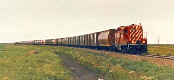
On a rainy vacation day, a plain old General Motors GP-9 pulls a long train of grain empties out of Portage.
It is running on the Minnedosa Subdivision which passes through many famous places, like ... um ... Minnedosa !
This secondary rail line radiates north-west from Portage and the CPR main line.
The white flags on the locomotive are a signal from the old railway rulebook used to indicate the train is an 'extra' ...
an unscheduled train which generally has no rights over other trains.
In point of fact, in 1985, all trains on the Minnedosa Sub are 'extras' ...
Time to rewrite the rulebook ... every thirty years isn't 'too often', fellas.
SAND
but no beach
Keep amovin' Dan, don't you listen to him, Dan
He's a devil, not a man, and he spreads the burning sand
With water.
Dan, can you see that big green tree
Where the water's running free and its waiting there for you
And me.
(Bob Nolan and the Sons of the Pioneers, 1941)
... don't worry
... there's plenty of water back at the camper where my aunt is reading the Globe and Mail.
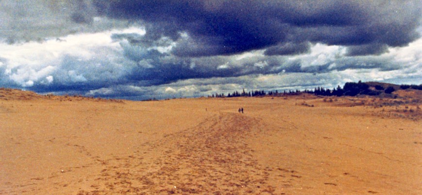
The photo above was taken during a visit to Spruce Woods Provincial Park, in the middle of the prairie,
where the sand dunes seem to go on forever.
The sand was left here by the ancient and mighty glacial version of the Assiniboine River.
It deposited all this sand at its delta ... as it slowed and flowed into the massive, glacial Lake Agassiz.
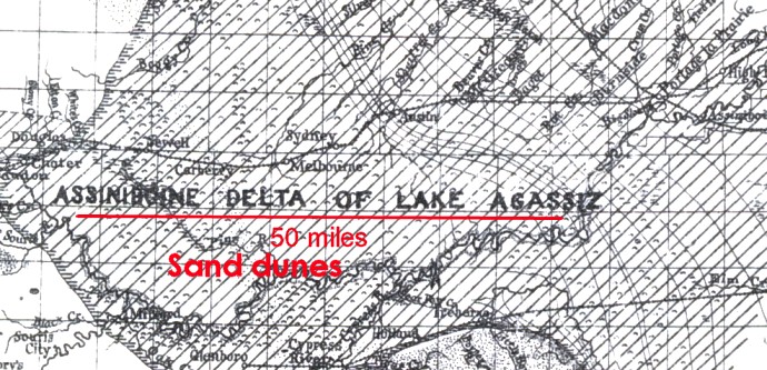
Above, a map from 1890. The red line is about 50 miles long.
The approximate location of deposited sand photographed above is shown.
Portage la Prairie is at the top right corner of the map.
Below, a map from 1895 by the same cartographer ... new, improved !
The red line is in approximately the same location and is also about 50 miles long.
Glacial Lake Agassiz can be seen from the bottom to the top of the map.
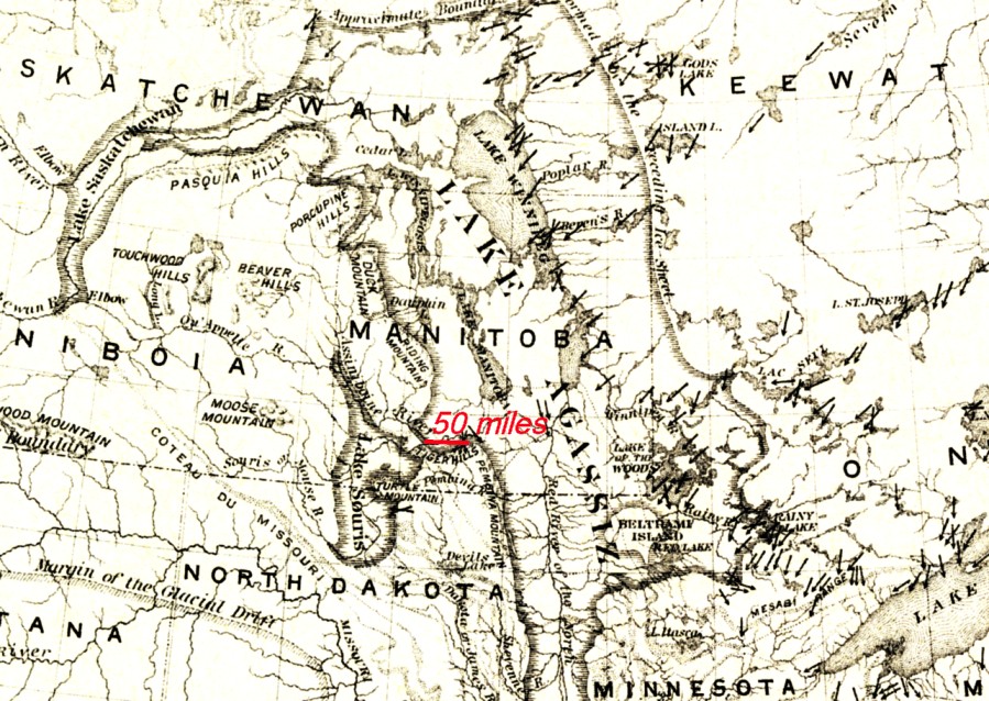
For a while, blocked by ice sheets to the north, Lake Agassiz drained into the Mississippi River.
While the course sand settled at the west end of the Assiniboine River Delta,
much of the finer material settled in the deep calm waters over today's Portage la Prairie.
The last areas of Lake Agassiz drained about 6000 years ago - before our western vacation trips began.
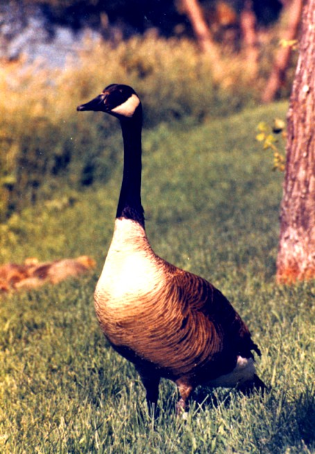
At the edge of the oxbow lake in Portage ... a Canada Goose 'On Guard !'
In the left background, huddled down in the short grass, are this year's new goslings.
A long lens keeps me safe from a good nipping.
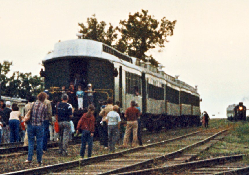
At Grosse Isle on the CNR Oak Point Sub, north of Winnipeg,
the train of the Prairie Dog Central awaits the return of the wyed (i.e. turned for the return trip) locomotive and first coach.
Except for the modern fashions and the great interest in the approaching steam locomotive,
this scene could have been taking place 80 years earlier on a prairie branchline somewhere.
My relatives seemed to have a tremendous tolerance for this 36 mile (round trip) excursion ...
because we all rode together virtually every summer.
The two of us did sometimes offer to go off to entertain ourselves so they might be spared ... to no avail.
With the train stationary on a leg of the wye while the track switches were being thrown,
my aunt sometimes reminisced about an earlier time in her life ...
sitting in a passenger coach, windows open, waiting on a siding in rural Quebec ...
fields of wildflowers, their scents, the warm breeze, birds, and distant locomotive sounds.
Occasionally, nostalgia was not enough ...
My aunt then adaptively reframed the experience of sitting on those historic, but hard, wicker seats for a few hours ...
triumphant as she identified yet another virtue of our essential annual pilgrimage back into Canadian history ...
she would reflect on the trip ...
' Well ... at least it's mercifully short . '
Back to sitemap