Southern Saskatchewan
Palliser's Triangle
A September 1989 Vacation
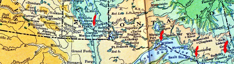
The red arrows represent quick photo stops during a highway trip from Kingston to Winnipeg.
Below, many photographs from 1989 are paired with postcards from around 1900.
Most of the postcards were hand-coloured and printed in Britain ... so often the colours are not exactly correct.
Sudbury
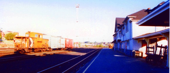
CPR Sudbury station early on a September morning.
The tracks lead off to the west.
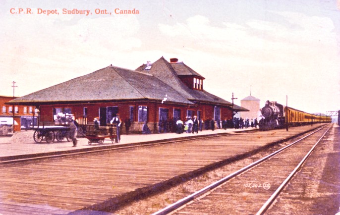
A post card mailed in 1912 shows an earlier version of the Sudbury station.
It seems likely this is a transcontinental train from Montreal.
The low heavy-looking baggage cart in the foreground might contain some kind of precious metal for the express car.
Sault Ste Marie
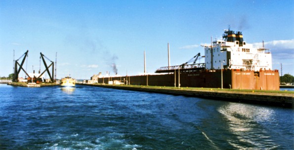
William J. DeLancey is the 'largest ship' on the Great Lakes ... this evening it is downbound between Lakes Superior and Huron.
Like many ships going back into history, its hull is designed for the tightest permissible fit in the locks it is to travel.
Too large for the St. Lawrence Seaway, self-unloaders of this size are captive to Lakes Superior, Huron and Michigan.
On our Sault Ste Marie harbour tour, we are followed by a similar tour boat from the Michigan side.
The Sault Ste Marie Canal (unlike today's main locks) is located on the
Canadian side of the St Mary's River and was completed in 1895.
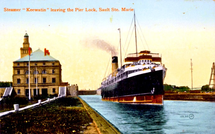
The CPR steamer SS Keewatin is seen here on its run from Fort William to Port McNicoll ...
sometime after the ship's 1907 completion in one of the famous Clyde River shipyards of Scotland.
The water route was offered by the CPR as an alternative to the train for this section ...
OR ... as part of a circle tour of the upper lakes ... train out, ship back ... or vice versa.
Thunder Bay (Fort William)
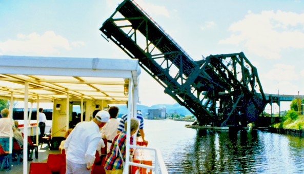
At the other end of Lake Superior we enjoyed another harbour tour.
This time we were with Rolly and Therese (neither is shown in this photo) at Thunder Bay.
Here the the 'Jackknife Bridge' lifts for our tour boat.
It carries 106th Street on the top level, and a CPR spur on the lower level.
To the right is Thunder Bay, to the left is Mission Island and then McKellar Island.
The bridge was built in Germany in the first decade of the 1900s.
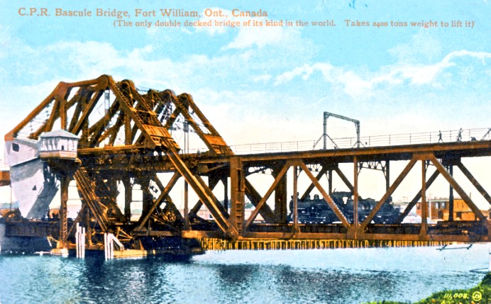
As the card suggests, the span weighed about 2400 tons.
You can see the grey counter-weight of approximately ... 2400 tons ... just to the left of the bridge-tender's office.
To 'lift' the bridge for an approaching ship,
the bridge-tender would set the appropriate signals to stop all rail and road traffic.
Then safety locks would be released (at the 'far end' from the bridge-tender) to allow the span to lift.
But the lifting force required would be relatively small ...
because of the precise engineering to balance the span with its counter-weight.
Beyond boosting a smart mechanical engineer's ego ... the reason for careful balancing is this ...
The lifting mechanism would wear out or fail much sooner if a too-large electric motor,
used too much electricity to fight the dead weight of the span, while both lifting and lowering.
It's not just smart to balance the bridge ... it is much more efficient and saves money.
A smaller, single deck railway bridge at Smiths Falls, Ontario was operated by the bridge tender, using a large hand crank.
This postcard featuring a German-built bridge was mailed August 3, 1914 ...
Just at that point ...
German armies were marching through Luxembourg and Belgium toward France as the Great War began.
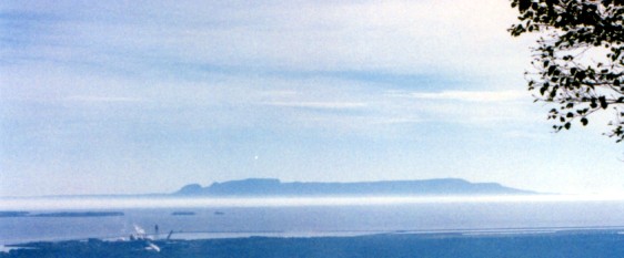
The 'Sleeping Giant' rock formation photographed during our visit to Mount McKay.
The 'head' at the left leads to the mainland and the feet are at Thunder Cape in Lake Superior.
(If you don't see 'him' don't worry ... it's kind of a stretch anyway)
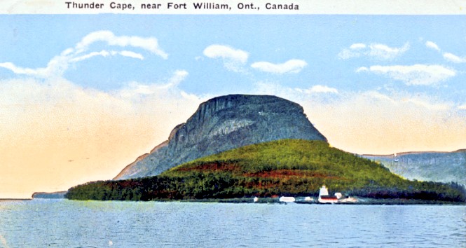
As it would be viewed from the SS Keewatin just after leaving Fort William's harbour ... here is Thunder Cape.
Winnipeg
Our vacation continues with a view from the 'Red River side' of Winnipeg's Union Station.
The box-like building with the copper-clad roof and towers is the Fort Garry Hotel.
The weathered green and black (passenger) train shed is between us and the station building.
Notice the 'ground level' access doors to the station's below-track areas.
Freight, express, and supplies would travel in and out of the station ...
under the tracks and away from the public 'front door'.
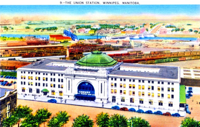
The much more prestigious 'front door' of CNR's Union Station.
The postcard and its colouring seems to display the 'art deco' style of the late 1920s and 1930s.
The bright colours almost lead one to believe that those may be palm trees below.
This view is from the upper levels of the Fort Garry Hotel.
The previous photo was taken where the freight yards once were in this view.
Palliser's Triangle
Spending a night in Moose Jaw and then returning to our relatives in Portage la Prairie, Manitoba via the 49th Parallel ...
we made a very quick tour of a unique part of Canada.
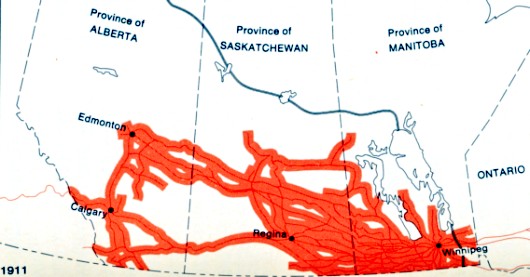
By 1911 these areas of the Canadian prairies were settled and appropriately served by railway lines.
The wider red bands represent the desired maximum distance to the railway line and a grain elevator ... 10 miles.
At this time, grain was transported in horse-drawn wagons.
You'll notice that south-east of Regina there is good coverage.
South-west of Regina only the CPR main line has been laid by 1911.
Why?
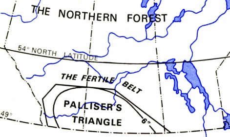
In 1857 the British Colonial Office had sent Captain John Palliser to
examine and report on these western lands to see if they should be
opened up for agriculture.
At that point they were still part of Rupert's Land ... the land grant given to the Hudson's Bay Company.
Palliser eventually divided the Prairies into two general sections: the 'fertile belt' ... and the 'true prairie' a semi-arid desert ... 'Palliser's Triangle'.
Professor H Y Hind was sent out by the Canadian Government at the same time and agreed this arid area was unsuitable for agriculture.
In spite of this, the Canadian Government acquired Rupert's Land from the Hudson's Bay Company in 1869.
Professor John Macoun accompanied the survey engineers of the
Canadian Pacific 1872-1882 and disagreed with Palliser and Hind.
Macoun pointed out that most of the rainfall came during the summer growing season.
However, it also seems likely he was there during an unusually wet period.
Railway competition, government subsidies, and grain shortages ...
during and following the Great War ...
encouraged increased settlement of the
semi-arid desert.
Sustained high grain prices concealed the potential problems of
settlement ...
until Europe's war-ravaged agriculture and economy
recovered.
Then the 1930s brought 'dustbowl' conditions here, and a general North American economic collapse ...
This prompted people to reconsider the wisdom of using much of Palliser's Triangle for agriculture.
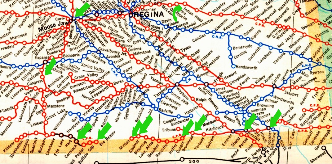
1950s railway map of southern Saskatchewan
We travelled in a counter-clockwise direction ... from Indian Head to Frobisher.
The green arrows indicate locations where photographs were taken.
This map repeats below for your pleasure and convenience.
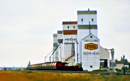
Indian Head on the CPR main line.
Say good-bye to the rain.
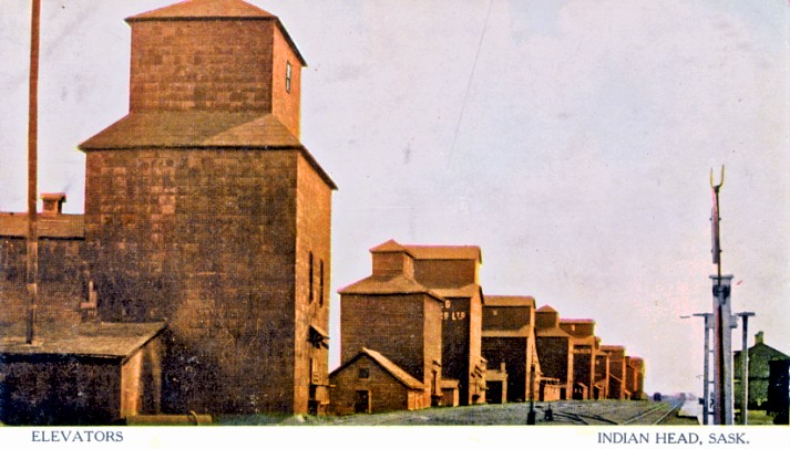
Looking from the opposite end of the Indian Head yard ... perhaps around 1890.
Notice the two story wooden station at the right - coloured green.
In front of it in the foreground, is the top of a the main yard switchstand,
with a bracket to hold a kerosene switch lantern at the top.
Moose Jaw
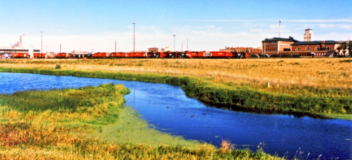
Moose Jaw in the morning showing the CPR station and yards on the transcontinental main line.
In front of the station are 3 pairs of covered stairwells which lead to the station via tunnels.
This was a common way of managing access to the train platforms and
avoided requiring passengers to walk across the busy main lines.
If you look at the map, you'll notice 6 CPR lines converging on Moose Jaw.
And before those historic days when multiple passenger trains arrived here at the same time ...
Moose Jaw was referred to as 'Monsochapiskanis' or 'Moose Jaw Bone Creek'.
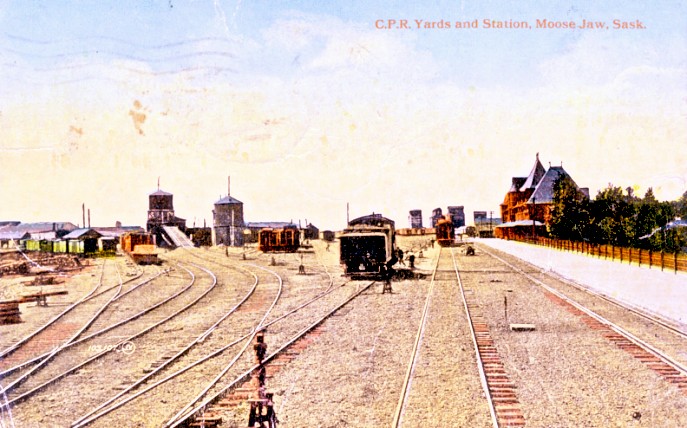
A simpler time at Moose Jaw.
It seems the yard has just been 'spread' with crushed rock.
From left to right, you can see
* car and engine shops
* the steep ramp to carry loaded coal cars to the top the coaling tower
* the water tower
* a yard for passenger equipment
* a switch engine
* a passenger train & grain elevators
* an earlier version of the station
This card was mailed on December 31, 1918
just after the Great War had ended and the Spanish flu was sweeping across the globe.
Heading south from Moose Jaw
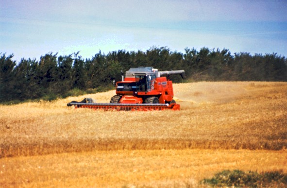
South of Moose Jaw we found a combine working on a small field.
The combine harvester 'combines' the operations of cutting the
wheat stalks and separating the grain from the stalks and chaff ...
it also stores the grain on-board as it cut, until it is unloaded
in bulk to a grain (dump) truck for transportation to an elevator.
Notice that the grain stalks here are quite short ... to resist being knocked down by rain and wind.
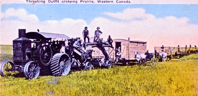
A steam-powered threshing machine being towed between jobs, and followed by harvesting teams towing equipment.
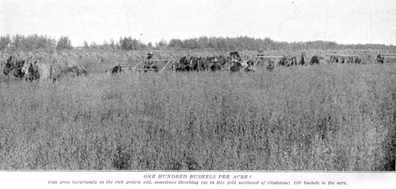
Taller old-style grain (oats) in Manitoba being cut and bound in sheaves for drying in the field, piled in stooks.
Losing the people, horses, and equipment behind the crop was the whole point of the photograph!
Back then, chest-high grain suggested excellent growing conditions (photo circa 1910).
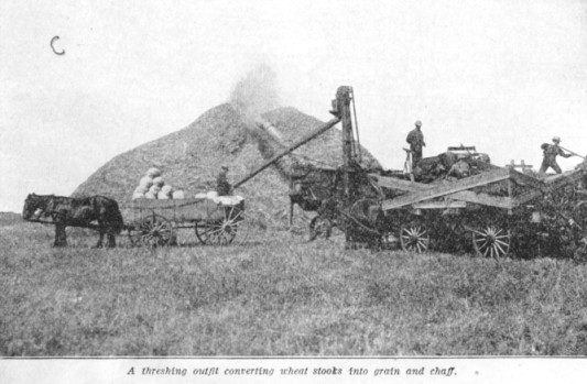
The dried bundles of grain stocks (sheaves) are hammered and shaken by the steam powered thresher.
The separated grain travels down the pipe to the wagon and into bags.
The stalks and chaff are blown into a pile and were usually burned later (photo circa 1910).
Heading south ...
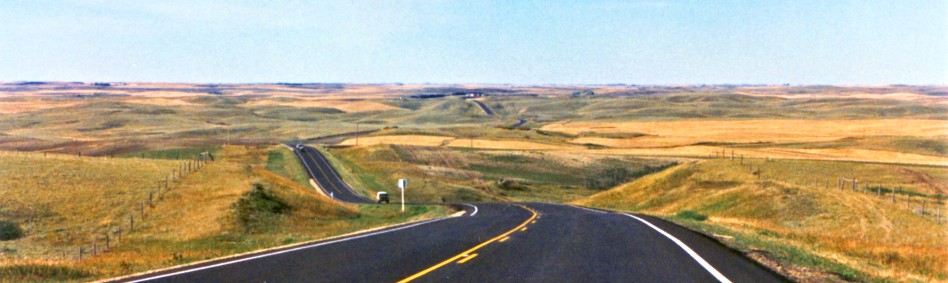
Near Congress, Saskatchewan.
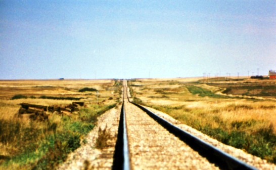
At mile 55.5 on the CPR Expanse Subdivision looking north.
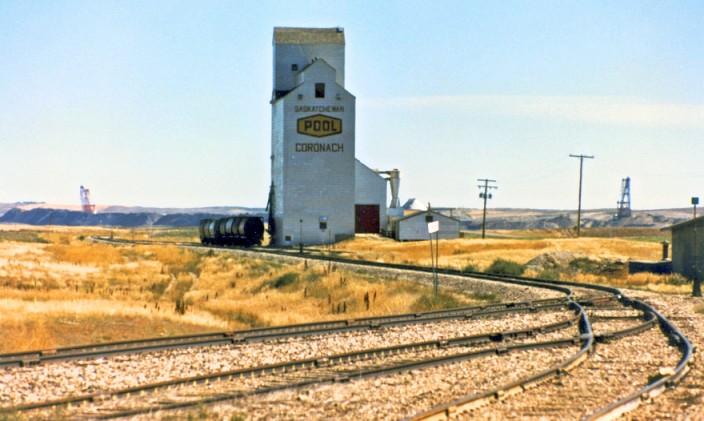
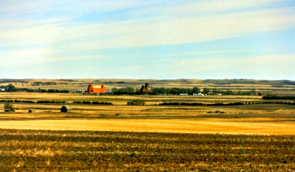
Coronach, Saskatchewan.
While the area may not live up to Macoun's expectations for agriculture,
you can see coal mining is doing well here.
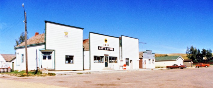
The 'end of the line' at Big Beaver.
The track had already been pulled up here.
The typically wide street and false front architecture are interesting.
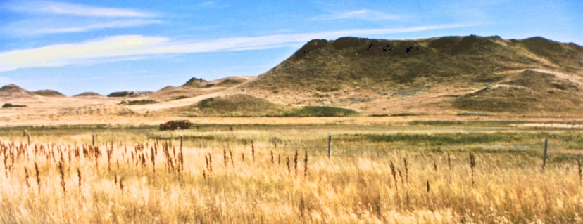
The Big Muddy Badlands east of Big Beaver
A hay rake waits for its next work at the left, centre.
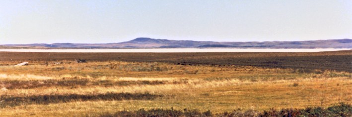
An alkali lake south of Minton.
Where rain is plentiful, we are comfortable with the idea that rain
will dissolve granular fertilizer and take it into the soil in solution
...
OK?
Here, in Palliser's Triangle, there is often a net deficit of precipitation for the year ...
At the level of the water table, water dissolves sub-surface pockets of various salts.
As the soil above it dries out ... the moisture and the dissolved salts travel to the surface.
The water evaporates, depositing the salts, and making the topsoil barren.
Obviously this will develop better (i.e. worse for farming) where a high water table meets a salt deposit near the soil surface.
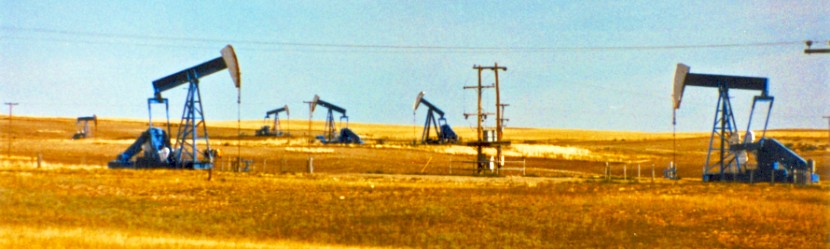
Oil wells near Gladmar.
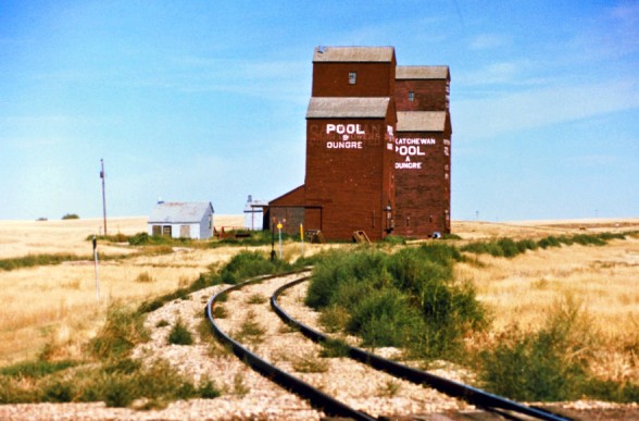
Oungre looking east at mile 39.4 Bromhead Subdivision
Bromhead, Saskatchewan
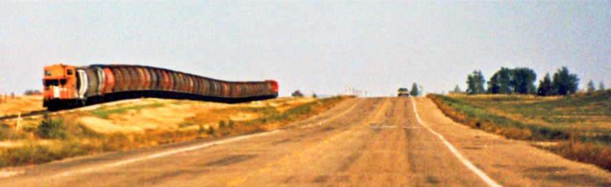
CPR eastbound 50 car grain train near Bienfait. Travelling at about 50 mph.
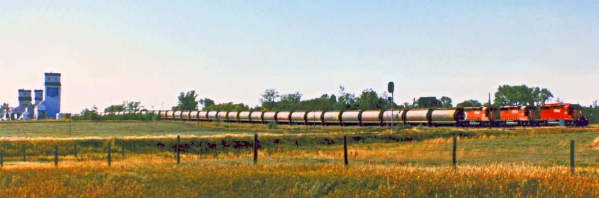
The same train travelling through the 15 mph interlocked crossing with the CNR at Frobisher.
The CNR absolute signal is seen in front of the third grain car.
The CPR semaphore protecting this diamond can be seen above the first of the grain cars disappearing behind the bushes.
Return to sitemap